Google Maps will tell you if your bus or train is crowded or late
MobileNews June 28, 2019 softonicadmin
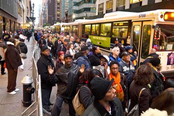
You’re rushing out the door for your commute. You get to the train station. The train doesn’t come when it’s supposed to. And when it finally does come, it’s jam-packed. Now you’re going to be late and your day is off to a terrible start.
Today, Google is trying to help commuters with two new features for public transit.
Google Maps is launching a live traffic delays feature for buses. Google already had bus delay information from some cities, but this new feature uses a machine learning model combining real-time car traffic forecasts with data on bus routes and stops to better predict how long a bus trip will take.
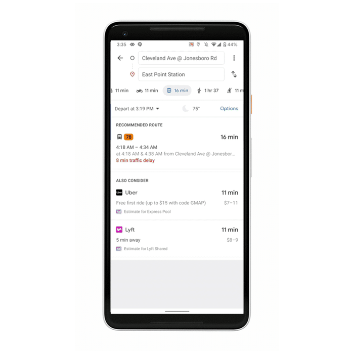
The company explains, “You’ll now be able to see if your bus will be late, how long the delay will be, and more accurate travel times based on live traffic conditions along your route. You’ll also see exactly where the delays are on the map so you know what to expect before you even hop on your bus.”
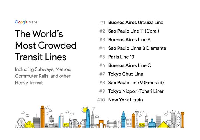
Google Maps will also include transit crowdedness predictions based on historical data. Find out if you’ll be packed in like a sardine or whether you’ll be able to splay across several seats.
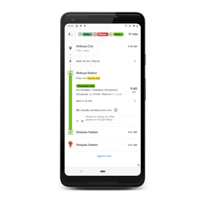
You can learn more about how busy your city’s commute is here.